Post by Almaron on Jun 27, 2019 11:13:13 GMT
Apologies if this is in the wrong place; none of the categories seemed quite right...basically, I wanted to start a thread about the Valyrian peninsula, and what we know about it so far, since it could be useful for mods set before the Doom.
Now, technically, there IS a canonical map that shows pre-Doom Valyria, and it's not the one you're probably thinking of from that special feature on the Game of Thrones DVD...it's this one; This might not be the most high resolution image of it, but this map is included at the start of the World of Ice and Fire companion book, and clearly shows an intact Valyrian peninsula with a few extra islands to boot. There are some minor issues with it; most notably, if you superimpose it over maps of modern Valyria means the two main roads connecting Valyria proper to the outlying cities would cross over water, but this can be fixed if we extend the coastline out slightly or presume that the Valyrians made some pretty long bridges.
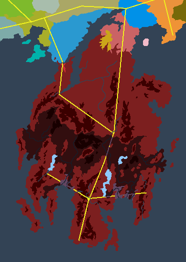
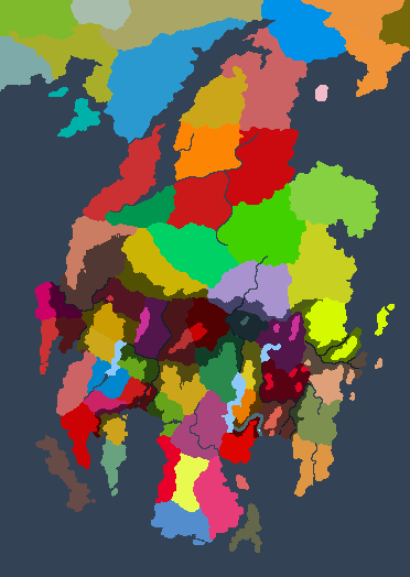
Anyhoo, I did trace this map a while back (you can see a picture showing the 'shadow' of old Valyria here; sta.sh/0cnujhz0p7q ), and just recently I returned to it, this time making notes of the 'mountain ranges' the colouration on the above map hints at, while also referring to the maps of Valyria in the Lands of Ice and Fire collection book, which show some rivers that haven't been included in the mod just yet (the picture above even includes a river on the west coast; difficult to see, but it does run straight through an area that is underwater now, suggesting that this was one of the river valleys that collapsed into the sea), and also reading through this fascinating blogpost for inspiration. Here's what I have right now...a hugely messy draft that has yet to be tidied up. Rivers one pixel wide have been traced from other maps, while the thicker blue lines are speculations on my part based on where parts of Valyria collapsed into the sea (and also where other rivers can be found, such as the one that flows past Oros on the LOIAF map; since the original settlers would have needed to get water from somewhere, I'm assuming this is a pre-Doom river that originally flowed for a much longer distance). I'll post more as I do more cleanup work on it, but for now, any thoughts on this, or things that we can add to it?
Now, technically, there IS a canonical map that shows pre-Doom Valyria, and it's not the one you're probably thinking of from that special feature on the Game of Thrones DVD...it's this one;
 This might not be the most high resolution image of it, but this map is included at the start of the World of Ice and Fire companion book, and clearly shows an intact Valyrian peninsula with a few extra islands to boot. There are some minor issues with it; most notably, if you superimpose it over maps of modern Valyria means the two main roads connecting Valyria proper to the outlying cities would cross over water, but this can be fixed if we extend the coastline out slightly or presume that the Valyrians made some pretty long bridges.
Anyhoo, I did trace this map a while back (you can see a picture showing the 'shadow' of old Valyria here; sta.sh/0cnujhz0p7q ), and just recently I returned to it, this time making notes of the 'mountain ranges' the colouration on the above map hints at, while also referring to the maps of Valyria in the Lands of Ice and Fire collection book, which show some rivers that haven't been included in the mod just yet (the picture above even includes a river on the west coast; difficult to see, but it does run straight through an area that is underwater now, suggesting that this was one of the river valleys that collapsed into the sea), and also reading through this fascinating blogpost for inspiration. Here's what I have right now...a hugely messy draft that has yet to be tidied up. Rivers one pixel wide have been traced from other maps, while the thicker blue lines are speculations on my part based on where parts of Valyria collapsed into the sea (and also where other rivers can be found, such as the one that flows past Oros on the LOIAF map; since the original settlers would have needed to get water from somewhere, I'm assuming this is a pre-Doom river that originally flowed for a much longer distance). I'll post more as I do more cleanup work on it, but for now, any thoughts on this, or things that we can add to it?


